Urban mobility is rapidly evolving, with innovative technologies transforming how we navigate bustling city landscapes. As metropolitan areas grow increasingly complex, the need for efficient trip planning solutions has never been more critical. Urban trip optimization algorithms are at the forefront of this revolution, offering smarter ways to traverse cityscapes while minimizing time, costs, and environmental impact.
These sophisticated systems leverage real-time data, machine learning, and advanced routing algorithms to provide travelers with optimal pathways through congested urban environments. By considering multiple modes of transportation and dynamically adjusting to changing conditions, urban trip optimization solutions are reshaping the way you experience city travel.
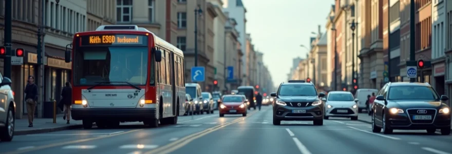
Urban mobility algorithms: powering trip optimization
At the heart of modern urban trip planning lies a complex web of algorithms designed to tackle the multifaceted challenges of city navigation. These algorithms process vast amounts of data to generate routes that balance efficiency, convenience, and user preferences. By considering factors such as traffic patterns, public transit schedules, and even weather conditions, these systems can provide highly personalized travel recommendations.
One of the key strengths of urban mobility algorithms is their ability to adapt to real-time changes in the urban environment. This dynamic approach ensures that you receive the most up-to-date and relevant route suggestions, even as conditions on the ground shift throughout your journey.
Moreover, these algorithms are continuously learning and improving. By analyzing historical data and user feedback, they can refine their predictions and recommendations over time, leading to ever more accurate and helpful trip planning assistance.
Real-time data integration for dynamic route planning
The effectiveness of urban trip optimization solutions hinges on their ability to incorporate real-time data from a multitude of sources. This integration allows for truly dynamic route planning that can adjust on the fly to changing conditions in the urban landscape.
Traffic flow prediction using machine learning models
Advanced machine learning models are revolutionizing traffic flow prediction, enabling more accurate travel time estimates and route suggestions. These models analyze historical traffic patterns, current road conditions, and even factors like weather and local events to forecast congestion levels with remarkable precision.
By leveraging this predictive capability, trip optimization algorithms can suggest routes that not only appear optimal at the start of your journey but are likely to remain so throughout your travel time. This foresight can help you avoid potential bottlenecks before they even materialize, saving valuable time and reducing stress.
Integrating public transit API feeds for multimodal journeys
Modern urban trip planners excel at creating seamless multimodal journeys by tapping into real-time public transit data. Through integration with transit agency APIs, these systems can access up-to-the-minute information on bus and train schedules, service disruptions, and even seat availability.
This integration allows for the creation of highly optimized itineraries that combine various modes of transportation, ensuring you can take advantage of the most efficient options available at any given moment. Whether it’s suggesting a bus ride to avoid traffic or recommending a subway transfer to bypass surface congestion, these systems help you navigate the city with unprecedented ease.
Leveraging crowdsourced data
Crowdsourced navigation platforms have become invaluable sources of real-time traffic and road condition information. By incorporating data, urban trip optimization solutions can tap into a vast network of user-reported incidents, from accidents to road closures.
This real-time, on-the-ground intelligence allows for rapid adjustments to route recommendations, ensuring you’re always on the most efficient path. The power of collective reporting means that even temporary obstacles or unexpected events can be quickly factored into your journey planning.
Iot sensors and smart city infrastructure for accurate congestion mapping
As cities become smarter, the proliferation of Internet of Things (IoT) sensors is providing unprecedented insights into urban traffic flows. These sensors, embedded in roads, traffic lights, and other infrastructure, offer a granular view of congestion levels across the city.
Trip optimization algorithms can use this data to create highly accurate congestion maps, allowing for precise route calculations that take into account even minor variations in traffic density. This level of detail enables the suggestion of alternative routes that might not be obvious to human planners, potentially uncovering hidden shortcuts through the urban maze.
Multimodal transportation optimization techniques
The complexity of modern urban transportation networks demands sophisticated optimization techniques capable of handling multiple modes of transport simultaneously. These methods ensure that you can seamlessly combine various travel options to create the most efficient journey possible.
Graph-based algorithms for efficient transfer point identification
Graph theory provides a powerful framework for modeling complex transportation networks. By representing the urban landscape as a graph, with nodes representing locations and edges representing connections between them, trip optimization algorithms can quickly identify optimal transfer points between different modes of transport.
These algorithms can analyze vast networks of pedestrian paths, bike lanes, bus routes, and rail lines to find the most efficient combinations. By considering factors such as walking distances, wait times, and the frequency of connections, they can suggest transfer points that minimize overall journey time while maximizing convenience.
Time-dependent Dijkstra’s algorithm for optimal route selection
The classic Dijkstra’s algorithm for finding shortest paths has been adapted to handle the time-dependent nature of urban transportation. This modified version takes into account how travel times can vary based on the time of day, allowing for more accurate route planning in dynamic urban environments.
By incorporating time-dependent edge weights into the graph model, these algorithms can account for rush hour traffic, varying public transit schedules, and other time-sensitive factors. This results in route suggestions that are optimized not just for distance, but for actual travel time based on when you’re making your journey.
Constraint programming for complex itinerary planning
When planning complex urban trips with multiple stops or specific timing requirements, constraint programming techniques come into play. These methods allow for the specification of various constraints, such as desired arrival times, maximum walking distances, or preferred modes of transport.
By solving these constraint satisfaction problems, trip optimization algorithms can generate itineraries that meet all of your specific needs while still optimizing for efficiency. This is particularly useful for planning day trips or complex business itineraries where timing and sequencing of activities are important.
User-centric features in urban trip planning applications
While the underlying algorithms are critical, the success of urban trip optimization solutions ultimately depends on their ability to meet user needs through intuitive and helpful features. Modern applications are incorporating a range of user-centric elements to enhance the trip planning experience.
Personalized route suggestions based on historical preferences
By analyzing your past travel patterns and preferences, trip planning applications can offer increasingly personalized route suggestions. These systems learn from your choices, taking into account factors such as your preferred modes of transport, typical travel times, and even favorite places to stop along the way.
This personalization extends beyond mere convenience; it can also account for accessibility needs, ensuring that suggested routes are always appropriate for your specific requirements. Whether you prefer scenic routes or the fastest possible path, the application adapts to your unique travel style.
Accessibility options for users with mobility challenges
Inclusive design is a critical aspect of modern urban trip planning applications. Features that cater to users with mobility challenges ensure that everyone can benefit from optimized urban travel. These might include options for wheelchair-accessible routes, audio navigation for visually impaired users, or suggestions for routes with minimal stairs or inclines.
By integrating detailed accessibility information into their databases, these applications can generate routes that not only optimize for time and convenience but also ensure a smooth and barrier-free journey for all users, regardless of their mobility needs.
Carbon footprint calculation and eco-friendly route prioritization
As environmental concerns become increasingly pressing, many urban travelers are looking for ways to reduce their carbon footprint. Trip planning applications are responding by incorporating features that calculate the environmental impact of different route options and prioritize eco-friendly choices.
These tools might suggest routes that favor public transit or cycling over car travel, or highlight options that result in lower emissions. By providing this information, they empower you to make informed decisions about your travel that align with your environmental values.
Augmented reality navigation for seamless urban exploration
Augmented reality (AR) is emerging as a powerful tool for enhancing urban navigation. By overlaying digital information onto the real world through your smartphone camera, AR features can provide intuitive visual guidance as you move through the city.
This technology can highlight turn-by-turn directions, point out nearby points of interest, or even display real-time public transit information floating above bus stops. By bridging the digital and physical worlds, AR navigation makes following complex urban routes more intuitive and less error-prone.
Future trends in urban journey simplification
As technology continues to advance, the future of urban trip optimization looks increasingly sophisticated and user-friendly. Several emerging trends are poised to further revolutionize the way you navigate cities.
Integration of autonomous vehicle fleets into trip planning
As autonomous vehicles become more prevalent, trip planning applications will need to incorporate these new transportation options into their optimization algorithms. This integration could lead to even more efficient and flexible urban mobility solutions, with autonomous vehicles seamlessly filling gaps in public transit coverage or providing last-mile connections.
The ability to summon an autonomous vehicle as part of a larger multimodal journey could dramatically reduce wait times and increase the overall efficiency of urban travel. Trip planners of the future might suggest routes that combine autonomous shuttles with traditional public transit to create optimal door-to-door itineraries.
Blockchain-based decentralized mobility marketplaces
Blockchain technology has the potential to create decentralized marketplaces for urban mobility services. These platforms could allow for direct peer-to-peer transactions between travelers and transportation providers, potentially reducing costs and increasing the diversity of available options.
In a blockchain-based system, trip planning applications could access a wider range of transportation services, from individual car-sharing offers to community-operated shuttle services. This increased choice and flexibility could lead to more personalized and efficient urban travel experiences.
Ai-powered personal travel assistants and chatbots
Artificial intelligence is set to play an increasingly prominent role in urban trip planning, with AI-powered assistants and chatbots offering personalized travel advice and real-time support. These systems could learn from your travel habits and preferences to proactively suggest routes and transportation options tailored to your needs.
Imagine a virtual travel companion that can anticipate your needs, warn you of potential disruptions before they occur, and seamlessly adjust your itinerary on the fly. Such AI assistants could make urban navigation feel more like having a knowledgeable local guide at your side at all times.
5G network utilization for ultra-low latency route updates
The rollout of 5G networks promises to bring ultra-low latency and high-bandwidth connectivity to urban areas. For trip optimization, this could mean near-instantaneous updates to route recommendations based on rapidly changing conditions.
With 5G, trip planning applications could potentially process vast amounts of real-time data from IoT sensors, vehicles, and other travelers to create a truly real-time picture of urban mobility. This could lead to even more responsive and adaptive routing suggestions, helping you navigate through dynamic urban environments with unprecedented ease and efficiency.